
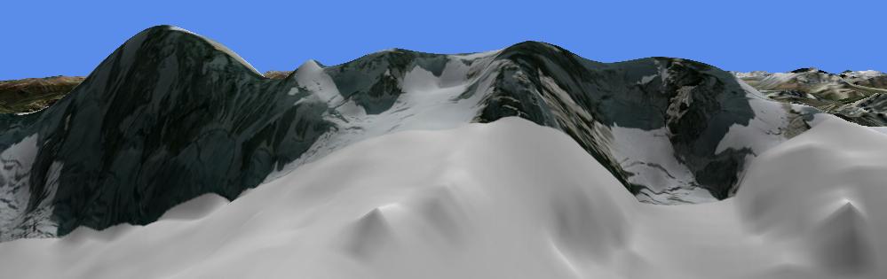
AIGUILLE DU GÉANT
Here are some flight simulator images of Aiguille du Géant, on the French-Italian border near Mont Blanc. The view is from the north. The true height of the Aiguille is 4013 metres. Although this aiguille is much smaller than the Matterhorn, its summit area is steeper, so it is an effective test of topographic realism. It is not possible to reproduce this summit accurately from the 3" source data used by the earth viewing services. Here is an external link to a photograph, although it's not quite from the same angle as the screenshots.
Shot 1. Source: default mesh provided by Microsoft. There is no Aiguille du Géant, and there is very little background detail.
Shot 2. Source: mesh created using SRTM data with a resolution of 3 arc seconds (3"). For most of the world, meshes like these have created much better scenery, but unfortunately, some areas of very high relief were not mapped. As can be seen, neither the Aiguille nor the ridge of which it is a part were mapped, but there is a considerable improvement in the background detail.

Shot 3A. Source: Google Earth, following a major terrain update in January 2007. A stunted Aiguille du Géant is on the right, but it does show up. The view extends eastwards as far as Grandes Jorasses (left).
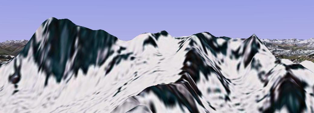
Shot 3B. Source: Microsoft Virtual Earth. The shot does reasonable justice to the ridge, although the profiles are too rounded, and the Aiguille does not show up at all. There is some good high resolution imagery, but locally there is no imagery at all.
Shot 4. Source: 76m-resolution (level of detail [LOD] 9) mesh created by FS Genesis using data that has been created from detailed topographic mapping, with a resolution of 1" (31m x 22m) re-sampled down to 3" (91m x 66m). The ridge, and the start of the Aiguille, can be seen. The virtual needle has an elevation of 3910m (true-103m). The digital models were downloaded from my DEM page.

Shot 5. Source: same data as shot 3, but the active mesh has been compiled at LOD10 (38m, not 76m). The mesh, which was created by Holger Sandmann, can be downloaded from AVSIM.

Shot 6. Source: Mesh France. This mesh is primarily from national survey digital data but according to its documentation there is input from the above shots 3 and 4 source in border areas. For border areas, the results are very similar to shot 4, but for most of France this mesh gives the best available coverage.

Shot 7. Source: 76m-resolution (LOD9) mesh EUDEM76 created by FS Genesis from the same source dataset as shots 3-4, but without the sampling down; the original 1" resolution has been retained. The improvements are significant. The virtual height has risen to 3957m (true-56m).
 .
.
Shot 8. Source: 19m-resolution (LOD11) mesh ALDEM19 created by FS Genesis from the same source as shot 6. The virtual height has risen to 3987m (true-26m). To reproduce this image on FS2004 it is necessary to set the Terrain Maximum Vertex Level to 21; this can be done by searching for and editing a file called fs9.cfg. A similar freeware mesh by Raimondo Taburet, downloadable from here, from the same source, gives broadly similar results, but, surprisingly, the virtual height of the Aiguille drops to 3966m. Another freeware mesh of the French and neighboring Alps, created by Alain Ragot, which can be downloaded here, restores it to the shot 7 height.
