This page provides a summary of how I have filled the no-data voids in the DEM data from the SRTM, using contours derived from topographical maps.
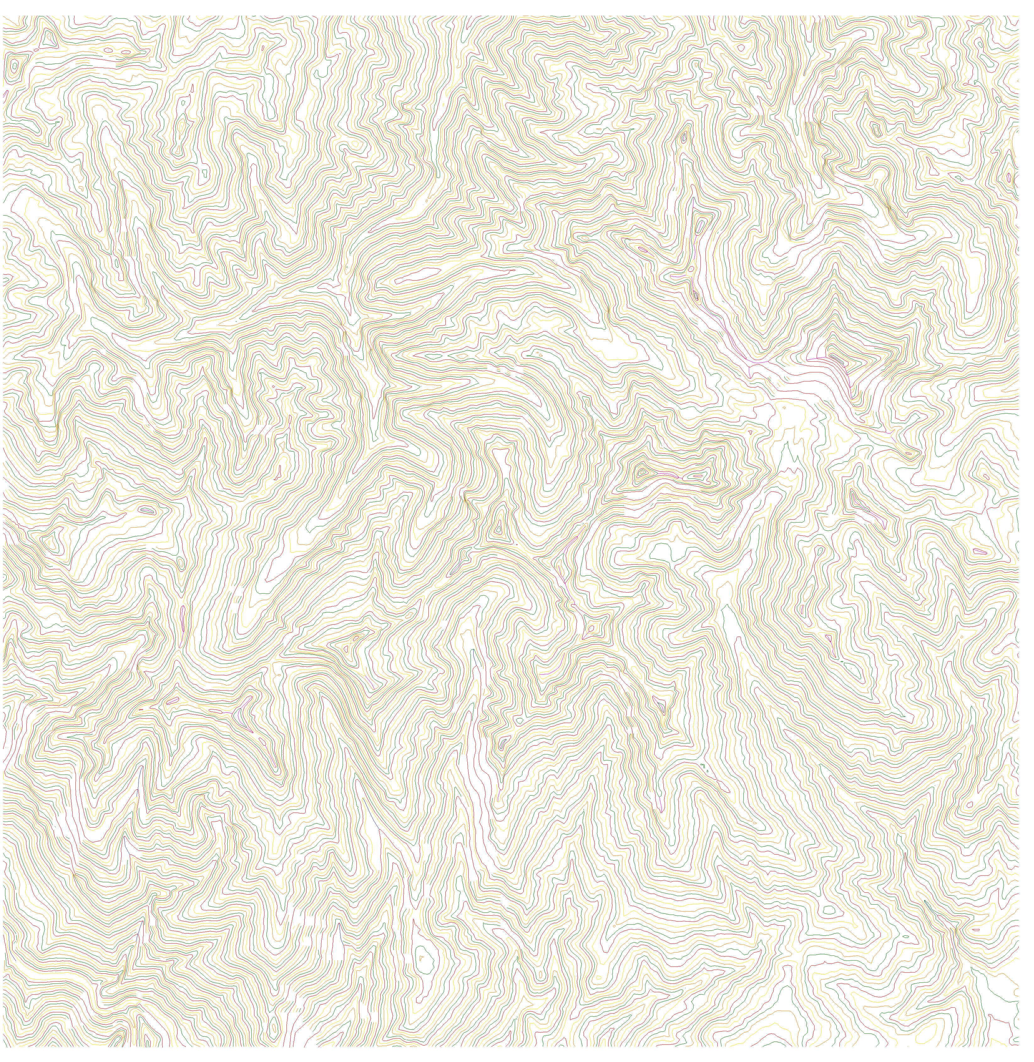
The source SRTM data is used to generate contours. See a sample of these contours, converted to GIF raster format. In this sample, the standard interval is 50 metres. The indices, shown in red, have an interval of 200 metres. The blank areas match the SRTM voids. The area shown was generated from a 15'x15' area whose south-west corner is at S 13°30' W 72°45' (Cordillera Vilcabamba, Peru).
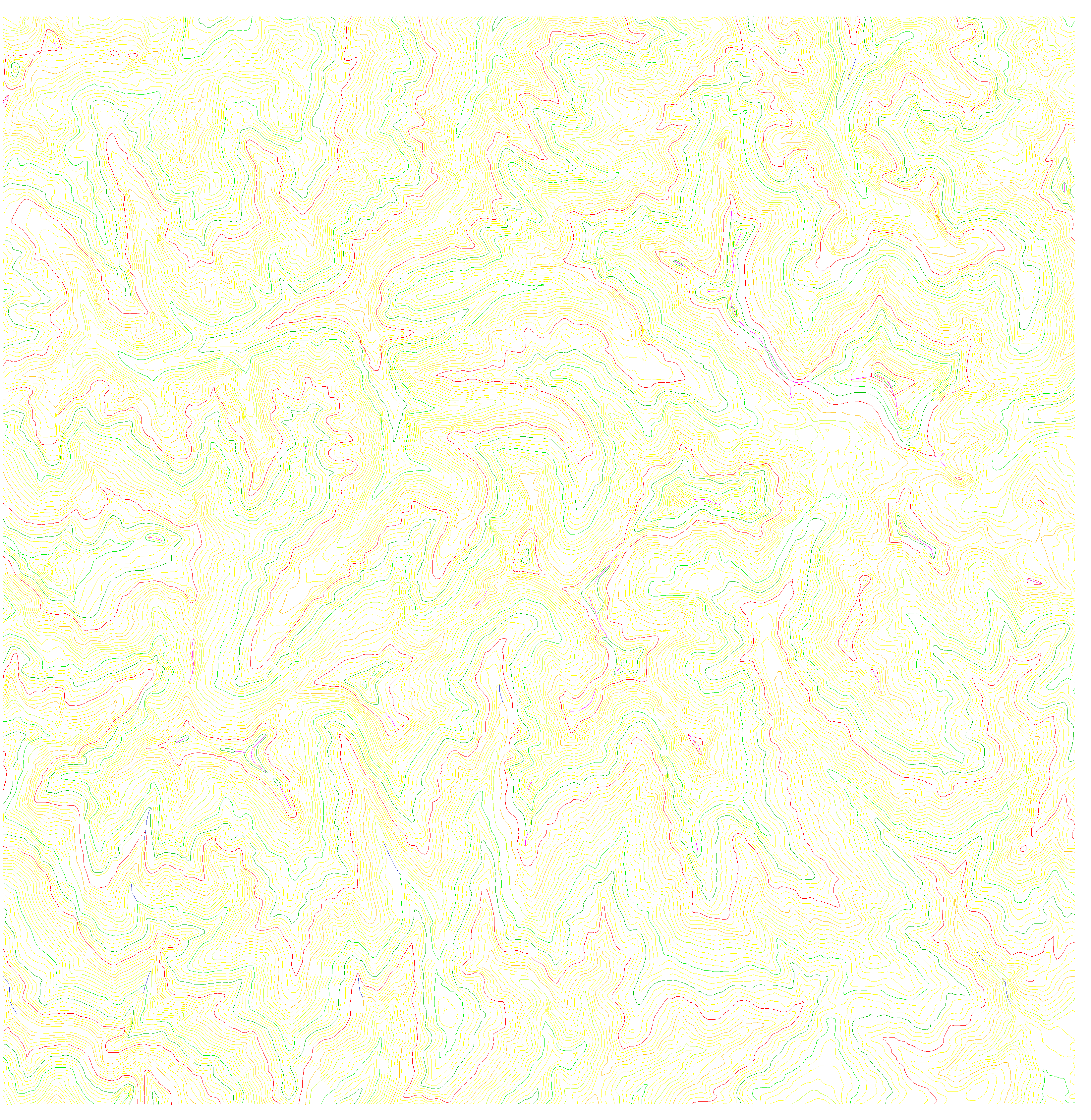
The contours are then extended to fill the void areas, with the help of underlaid topographic mapping and various line tracing algorithms. In some places, 3D contours are created, these are shown in purple and dark blue. There are also some spot heights, although these do not show up clearly in the image. See also the same contours, but with the color map amended to highlight the indices.
The extended contours are then used to create a new DEM's. These are merged with the original SRTM model, retaining all the existing source SRTM data. The contour extension process described above means that discontinuities do not occur.
Occasionally there are phase unwrapping errors in the original SRTM data. These are detected and marked during in the contour extension process, and the contours generated from the affected areas are erased. In these areas, the original SRTM data is overridden. But this process has not been applied to some of my earliest uploads; these will be updated soon.
For an inventory of downloadable tiles with mountain voids filled using the above method, go to my main Digital Elevation Model Page.
ASTER GDEM. The 2009 and 2011 releases of a global ASTER GDEM dataset, with 1" postings, may also have been noticed. I welcome and make use of this new free data source, but I invite readers to read my initial review of these data before getting too excited.
Despite their shortcomings, I have used ASTER data to help me to fill many areas where topographic coverage is either unavailable or of poor quality. The procedure was as follows: